Aerial of Red Hook, Brooklyn in 2100

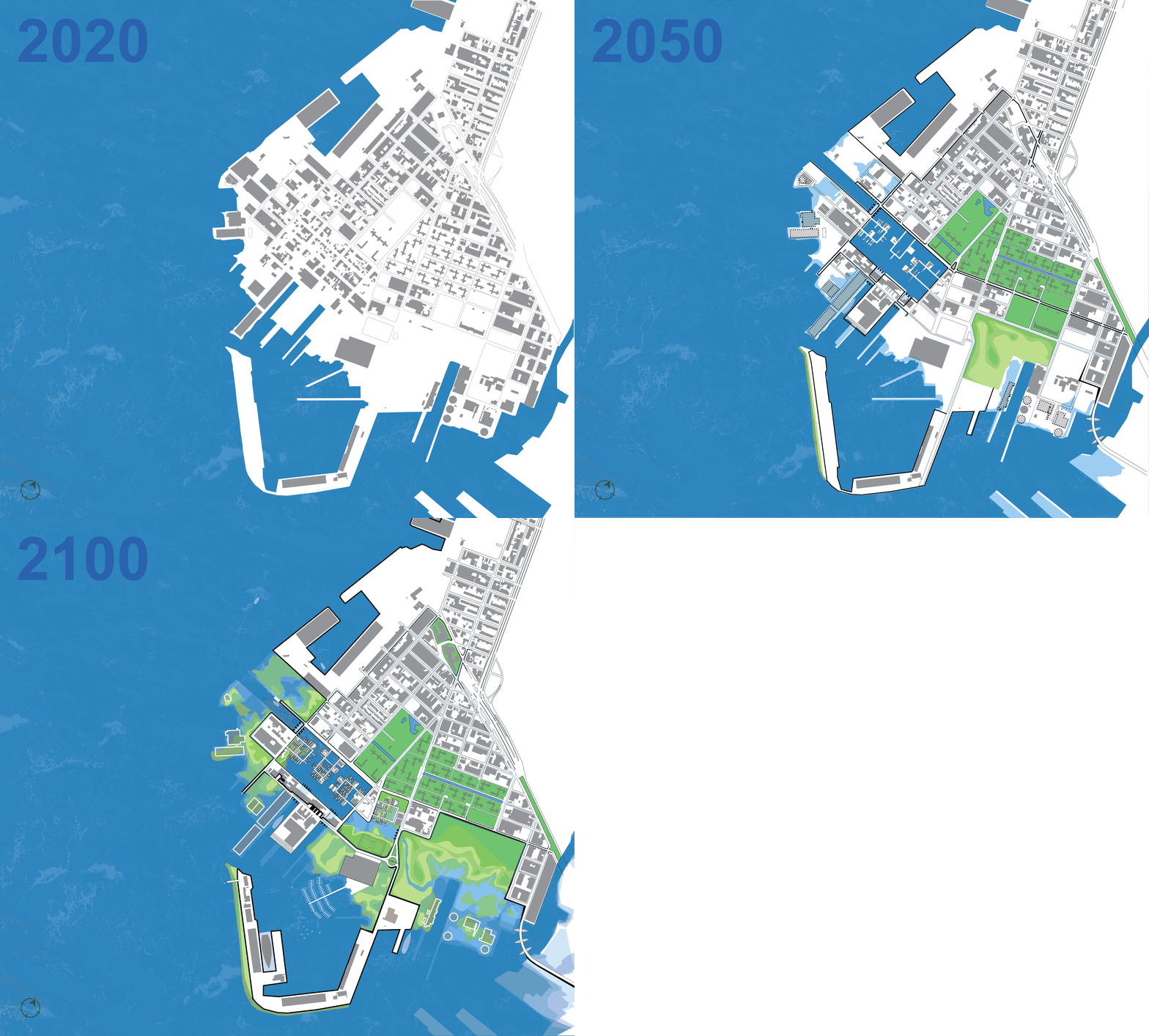
Response to inundation in 2020, 2050, and 2100


View of floating neighborhood from Conover Bluff

Recreational Ruins

NYCHA rooftops for refuge

Water mitigation canal and landscaping

Le BQE Marais

Backyard bayous

Industrial wetlands

Tidal flood zone oak tree farm

Pump station children's center

"Below The Flood" neighborhood mural

Tidal play street: Low Tide

Tidal play street: High Tide
Amphibious Red Hook
Brooklyn, NY
2016
The Amphibious Red Hook plan is a multi-layered protection and development strategy for living with water that both protects from the negative impacts of sea level rise and creates a model for equitable, resilient growth for Red Hook and beyond. This is accomplished by creating redundant layers of protection from climate and mitigation of storm water to minimize damage and loss of life, integrating education and social cohesion with the built and engineered components of the Integrated Flood Protection System (IFPS), and providing a regional benefit by growing the renewable wind energy sector, providing jobs, and generating clean energy with capacity to power millions of homes.